Welcome to the home page of the Space Geodesy Programme of the Hartebeesthoek Radio Astronomy Observatory (HartRAO). HartRAO is located North-West of Johannesburg in South Africa.
Geodesy, also called geodetics, a branch of earth sciences, is the scientific discipline that deals with the measurement and representation of the Earth, including its gravitational field, in a three-dimensional time-varying space. Geodesists also study geodynamical phenomena such as crustal motion, tides, and polar motion. For this they design global and national control networks, using space and terrestrial techniques while relying on datums and coordinate systems. (http://en.wikipedia.org/wiki/Geodesy )
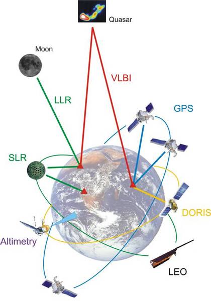
The Space Geodesy Programme participates in global networks which uses applications of Very Long Baseline Interferometry (VLBI) and the Global Positioning System (GPS) to do research in geodesy. HartRAO is an IGS Regional Data Center. HartRAO operates an SLR (Satellite Laser Ranging) system (MOBLAS-6) in collaboration with GSFC, Washington. Having three main space geodesy techniques located on the same site positions HartRAO to play an important role in international space geodesy networks. This collocation makes HartRAO a true fiducial site.
