GNSS
 |
|  | Hits: 21640
Translations: French
GPS (RINEX) data and IGS precise ephemeris
Currently we archive data for 27 IGS stations, and 1 regional station (NAMI). The archive covers the period from January 1998 to present:
- HRAO (HartRAO, Hartebeesthoek, South Africa [HRAO/JPL])
- HARB (SAC, Hartebeesthoek, South Africa [CNES])
- SUTH (Global IGS station, SAAO, Sutherland, South Africa [HRAO/JPL])
- SUTM (SAAO, Sutherland, South Africa [GFZ/SAAO])
- RBAY (Richardsbay, South Africa, [HRAO/JPL])
- SIMO (Simonstown, South Africa, [HRAO/JPL])
- ASC1 (Ascension Island [JPL])
- MALI (Malindi, Kenya [ESA/ESOC])
- OHI2 (O'Higgins, Antarctic Peninsula [BKG])
- DAV1 (Davis, Antarctica [AUSLIG])
- KERG (Port aux Francais, Kerguelen Islands [CNES])
- VESL (SANAE IV, Antarctica [AWI])
- GOUG (Gough Island [AWI])
- MAW1 (Mawson, Antarctica [AUSLIG])
- PALM (Palmer, Antarctica [])
- NAMI (Windhoek, Namibia [HRAO/JPL])
- SEY1 (La Misere, Seychelles [JPL/IDA])
- YKRO (Yamoussoukro, Cote D'ivorie [NASA/JPL])
- CAS1 (Casey, Antarctica [AUSLIG])
- TGCV (Tide Gauge at Cape Verde [Pacific GPS Facility])
- LPGS (La Plata, Argentina [GFZ, Potsdam])
- MBAR (Mbarara, Uganda [JPL])
- MAS1 (Maspolomas, Gran Canaria [ESA/ESOC])
- MSKU (Masuku, Franceville, Gabon [JPL])
- NKLG (N'Koltang, Libreville, Gabon [CNES])
- RABT (Rabat, Morocco [UNAVCO])
- SYOG (Syowa, Antarctica [Geographical Survey Institute, Japan])
- ZAMB (Lusaka, Zambia [HRAO/JPL])
The RINEX data is archived in the structure year/doy (day of year). Therefore to retrieve data for (say) February 5, 1998, you should access the data stored under 1998/036. IGS products are stored per GPSweek. If you have any problems regarding data or product retrieval, or would like to have other data or products added, please contact me. If you have used this archive, please e-mail me so that I can add your details to our database. This will allow us to inform you of any important changes to this site or allow us to inform you about events in geodesy which might possibly interest you.
You can access a data holdings summary, which is structured by year. The most current file is updated daily. Please keep in mind that some stations tend to be later than others, especially those located on very remote sites. Data files which in general are not available after a week, probably means that the station involved was down for that period.
The most recent log files for the IGS stations can be downloaded from here.
Files with a .gz extention have been compressed with gzip. On UNIX or LINUX platforms they can be expanded with the 'uncompress' or 'gzip' command. There is a DOS gzip utility available for download.
Download IGS Broadcast Ephemeris (Rinex)
Download IGS Precise ephemeris
Download data holdings summaries
Download latest IGS log files
ITRF96 Coordinates (GPS)
GNSS Basestation Velocities
Global Navigation Satellite System (GNSS) basestations using signals from GPS and GLONASS measure positions at cm levels and so show tectonic plate motion when monitored on long timescales. Several HartRAO-operated GNSS basestations appear in this station velocity map created by the Jet Propulsion Laboratory (JPL).HartRAO and collaborators operate base stations used by the International Global Navigation Satellite System Service (IGS) that are listed below.
- Hartebeesthoek, South Africa GPS HRAO time series and data log
- Richards Bay, South Africa GPS RBAY time series and data log
- Simon's Town, South Africa GPS SIMO time series and data log
- Sutherland, South Africa GPS SUTH time series and data log
- Vesleskarvet, Antarctica GPS VESL time series and data log
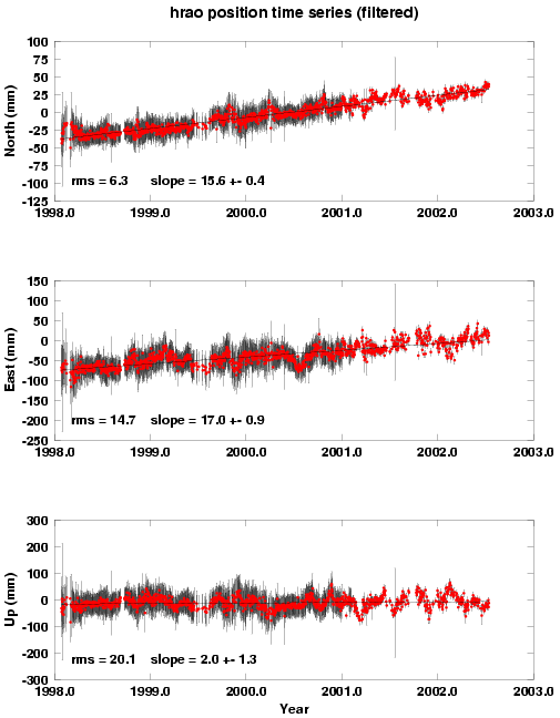
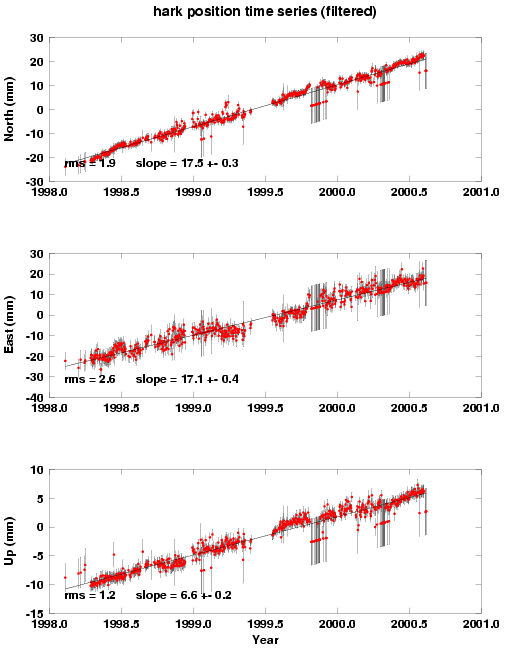
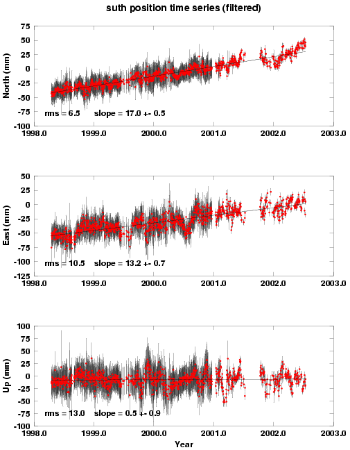
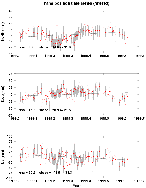
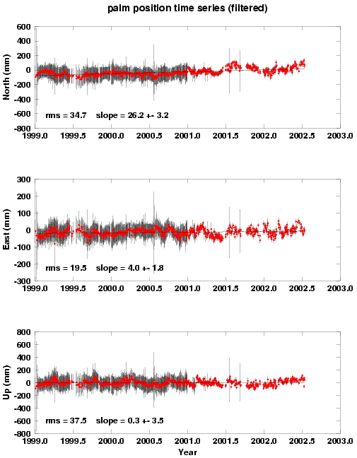
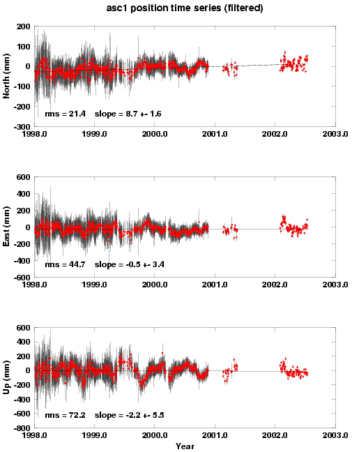
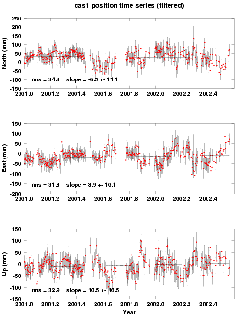
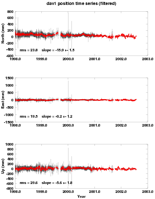
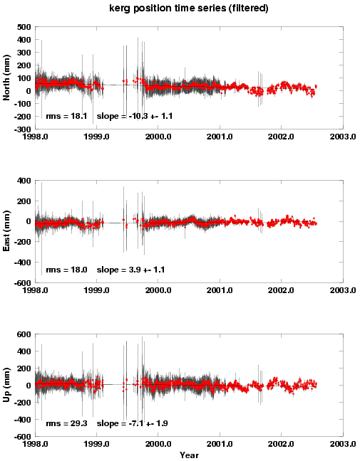
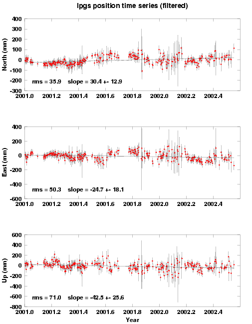
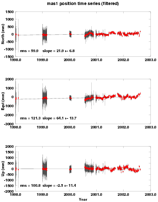
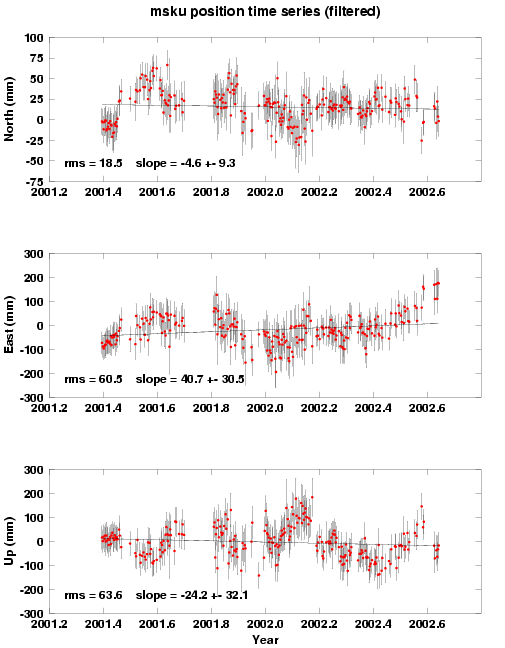
View some of our timeseries plots:
- postscript HRAO or GIF format HRAO
- postscript HARK or GIF format HARK
- postscript HARB or GIF format HARB
- postscript SUTH or GIF format SUTH
- postscript NAMI or GIF format NAMI
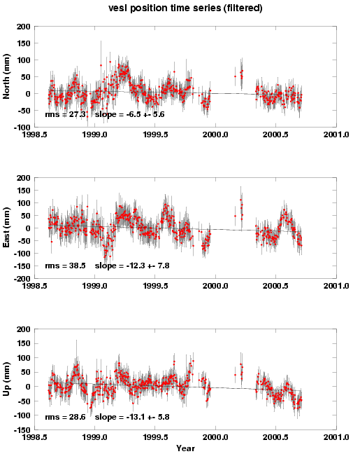
- postscript VESL or GIF format VESL
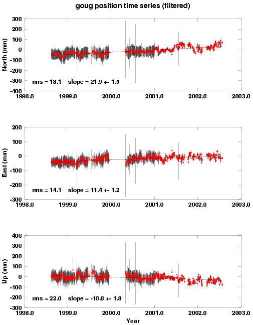
- postscript GOUG or GIF format GOUG
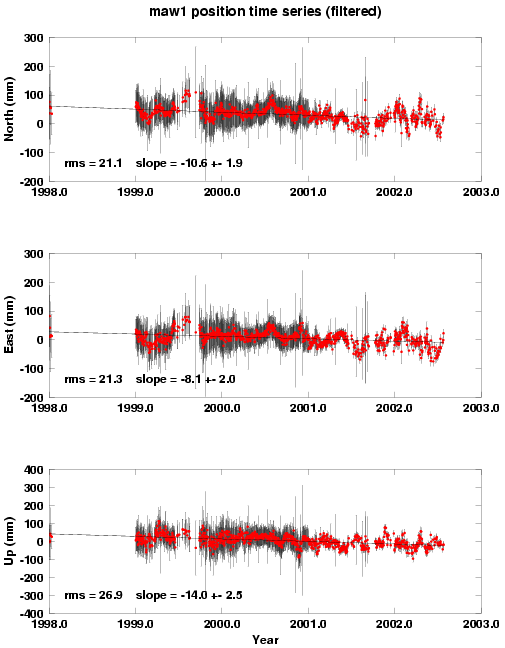
- postscript MAW1 or GIF format MAW1
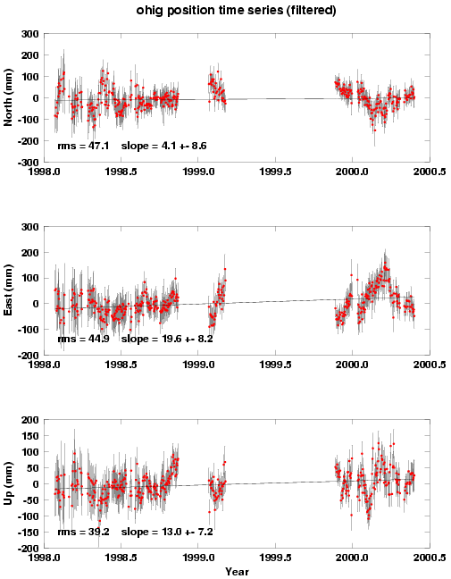
- postscript OHIG or GIF format OHIG
- postscript PALM or GIF format PALM
- postscript ASC1 or GIF format ASC1
- postscript MALI or GIF format MALI
- postscript CAS1 or GIF format CAS1
- postscript DAV1 or GIF format DAV1
- postscript KERG or GIF format KERG
- postscript LPGS or GIF format LPGS
- postscript MAS1 or GIF format MAS1
- postscript MSKU or GIF format MSKU
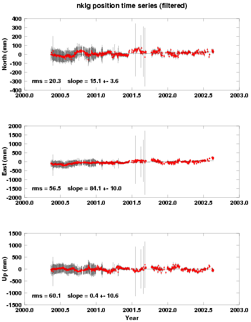
- postscript NKLG or GIF format NKLG
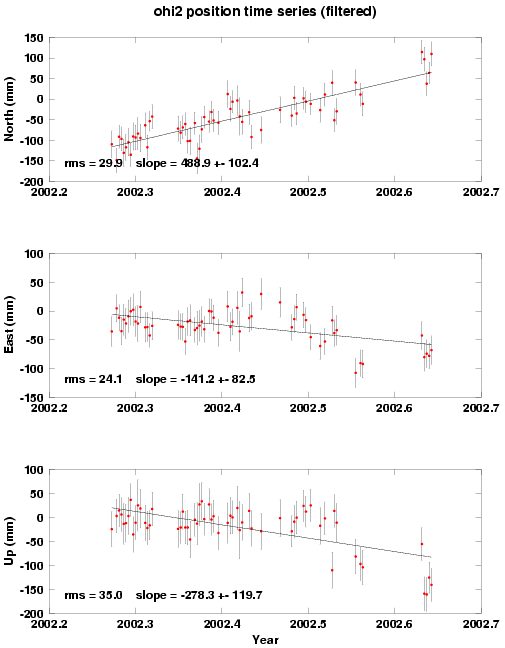
- postscript OHI2 or GIF format OHI2
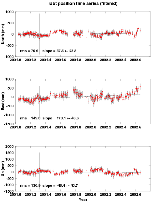
- postscript RABT or GIF format RABT
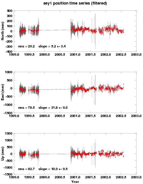
- postscript SEY1 or GIF format SEY1
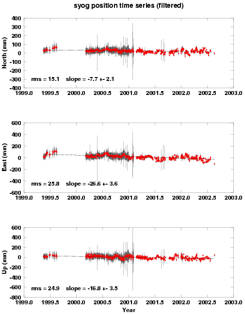
- postscript SYOG or GIF format SYOG
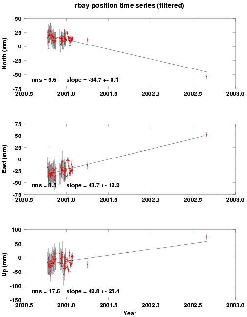
- postscript RBAY or GIF format RBAY
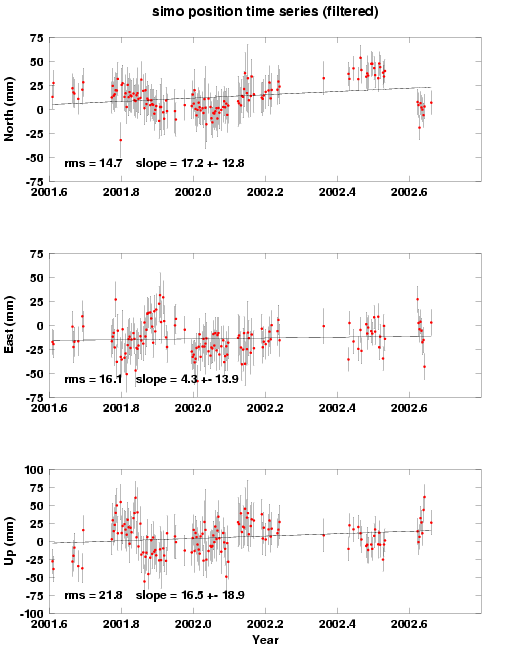
- postscript SIMO or GIF format SIMO
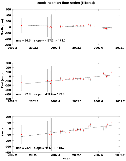
- postscript ZAMB or GIF format ZAMB