Project Overview
|
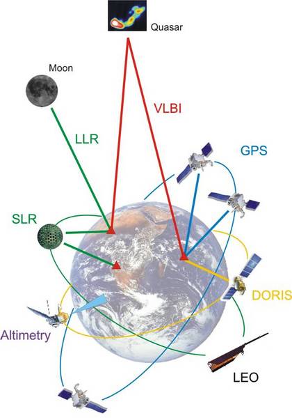
The proposed Space Geodesy Outstation is planned to be the hub of Space Geodesy in South Africa, as well as to become a major player in Space Geodesy in the world.
This venture is a project of the Space Geodesy Programme, based at Hartebeesthoek Radio Astronomy Observatory (HartRAO). The new Space Geodesy Outstation has in mind to facilitate all the different Space Geodesy systems available - just like it is currently done at HartRAO. A big extra will be a Lunar Laser Ranging (LLR) device.
The project White Paper is available under The Project --> Research Perspectives
|
|
Potential Outstation Sites
There are a few crucial requirements that must be fulfilled for a site to be considered:
- Clear Skies: Clear skies are a very important aspect of astronomy. Things like weather (how often is it cloudy), pollution, light-pollution, etc. are all evaluated.
- Low Horizon: An average horizon level of about 15° or better is usually a good horizon level.
- Minimum noise: The noise referred to here is electro-magnetic noise in the form of radio- and microwaves. A simple, everyday thing like a microwave oven for instance, generates massive amounts of microwave noise, so it is desirable to have this as small as possible.
- Access to basic resources: Basic resource include water, electricity, a good road for easy access, etc.
We have identified three different sites within South Africa that seems to have all the right attributes for the new Outstation. In the subsequent sections we will present these sites along with the advantages and disadvantages that they have.
The three sites are (in no particular order):
As you come accross the Lesotho border from Kwazulu-Natal - through the Sani Pass, you will pass a near perfect location. Situated at an altitude of 3300m in the mountains, this site offers almost everything: A clear sky, a very low horizon (negative horizon in most directions), no nearby development of major cities, etc.
Even though Lesotho is such a good option for the Outstation, it does have one real disadvantage: it is too far from crucial resources such as electricity and water, and it is also not very accessible.
|
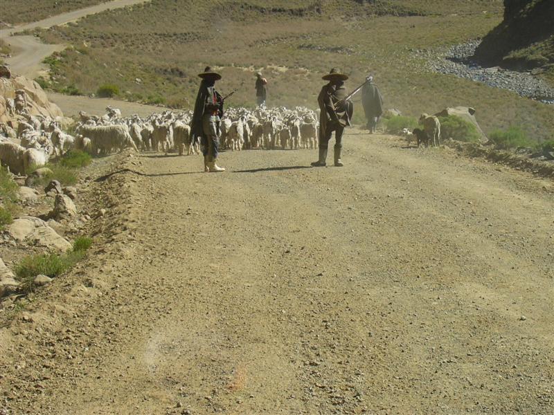
A typical scene in Lesotho: herder boys tending to their livestock. |

A panoramic view of Lesotho from the potential Space Geodesy Outstation site. Here you can see the clear skies and the low horizon that makes this such a good option. Most of the skyline is 'below horizon' due to the extreme height of this site.
Sutherland is already host to the South Africa Astronomical Observatory (SAAO) and also has a lot to offer: Clear skies and low pollution levels are some of reasons why the SAAO is situated here. Being close to SAAO could encourage resource sharing between Space Geodesy and SAAO.
|
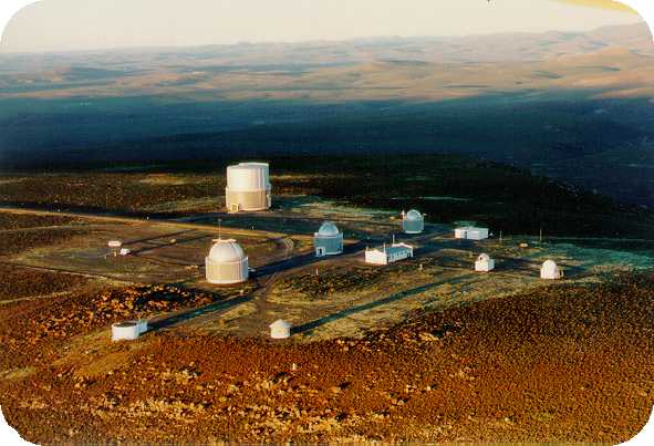
In this picture you can see the SAAO near Sutherland. The site we have in mind for the Outstation is just off the picture in a valley. |
Matjiesfontein is a little town situated in the semi-arid region of the Karoo on the N1 highway to Cape Town. Matjiesfontein offers a number of benefits in terms of cloud cover, seeing conditions and site stability - one of the main criteria for a geodetic site. We have had several discussions with the management and owner of Matjiesfontein and a tract of land towards the south of the town has been identified which will suit our purposes very well. In addition, a new water source has been found nearby and an overhead high voltage line is about 1km from the site.
Matjiesfontein has a good existing infrastructure: railway line, N1 national road, landing strip, water and electricity. Furthermore, the infrastructure at the village itself provides opportunities to host workshops and conferences.
|
The proposed site for the Outstation is enclosed in a natural valley which would protect the site from RFI and would reduce visual impact from the road. An existing gravel road services the site. The village is about three km towards the north. |

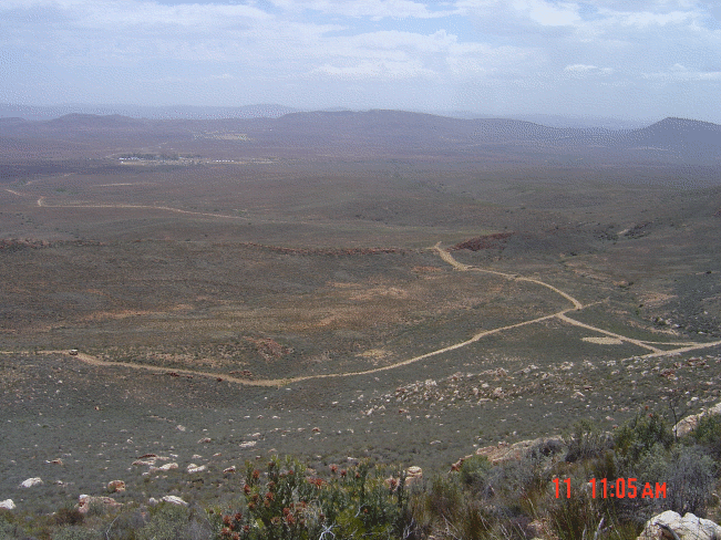
A panoramic view of the site in Matjiesfontein. This picture is taken from one of the hills next to the site.


